


Località
Montecoronaro - localita
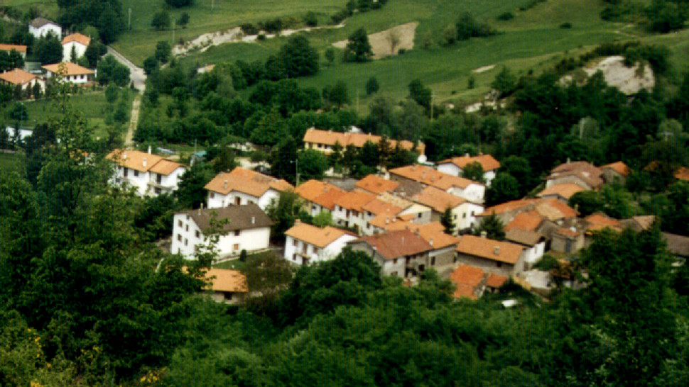
Montecoronaro
Located between the slopes of Poggio Vergataio and Poggio Alto, next to one of the easiest mountain passes of the pennines (865 mt a.s.l.) which has been an easy natural communication route between the valleys of the Savio and Tevere rivers between the north and south of Italy. In recent decades the town has been transformed by the construction of numerous small houses in an extensive residential area which give it the appearance of a holiday camp. However, the old centre with its stone houses, narrow streets, drinking trough, the Oratory of San Giovanni, the customs building.., has millennial history. In fact documents refer to a "castrum Montis Cornarii", located on a steep hill and belonging to the Guidi Counts of Bagno, which in 1274 became the property of the nearby Abbey of S. Maria in Trivio. After the destruction of the castle the population moved to the nearby hamlets of Cameragio and Pianello working and managing the lands of the small but powerful Camaldolite abbey. The abbey then went into decline and all that remained was the church which was attended for centuries by the local population. In 1807 a new parish church was built in the centre of Pianello and named Santa Maria del Trivio after the abbey: that year Montecoronaro was the most populated part of the parish but very soon changing economic conditions forced its inhabitants, small landowners and farmers, to emigrate annually to Maremma.